
Why is El Niño so hard to predict?

Forecasting is hard. Anyone who has planned a surf trip around a swell that evaporated, or skipped a day that turned out to be pumping, knows this. Even with satellites, buoys, and sophisticated models, predicting what the ocean will do days in advance remains humbling work. Now stretch that challenge across an entire ocean basin and months into the future. That’s ENSO forecasting.
The 1982-1983 El Niño caught the scientific community off guard. One of the strongest events of the century, and nobody recognized it until it was already happening. The tropical Pacific simply wasn’t being watched closely enough. Ship-based measurements revealed the warming months after it began, too late for any kind of warning.
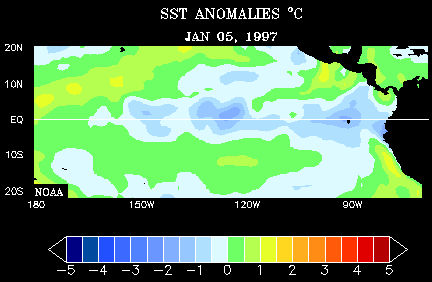
The first successful El Niño forecast came in 1986, predicting the 1986-87 event. That was a milestone - proof that these things weren’t completely random. But success has been inconsistent. The 1997-1998 El Niño was the best-observed event in history, tracked by a network of buoys across the Pacific transmitting data in real time. But models still missed how strong it would become.
The problem is that the ocean and atmosphere don’t take turns on the playground. They’re influencing each other constantly, which means you can’t model one and then the other. You have to simulate both simultaneously and get their interaction right. A slight miss in sea surface temperature nudges the winds, which nudge the currents, which feed back into temperature. Run the model forward a few months and small errors have snowballed into entirely different forecasts.
Compounding errors aside, there’s the question of what kicks off an El Niño in the first place. The Pacific can sit in a primed state for months: warm water pooled in the west, thermocline tilted and ready. Nothing happens. Other times, a burst of westerly winds lasting a week or two triggers the whole cascade. These wind bursts are tied to larger atmospheric patterns that remain difficult to predict more than a couple weeks out. Whether a particular burst will matter depends on where the ocean already sits, a combination of timing and luck that models struggle to capture.

NOAA issues probabilistic forecasts, giving percentage chances for El Niño, La Niña, or neutral conditions several months ahead. These outlooks are useful, but they’re probabilities, not certainties. The 2015-2016 El Niño was forecast reasonably well. The strong El Niño predicted for 2014 fizzled before it fully developed. Spring is particularly tricky, with forecasters calling it the “spring predictability barrier” because the system is in transition and small nudges determine which direction it goes.
Despite all this uncertainty, the forecasts aren’t useless. What the models can tell us is when the odds are elevated. A strong El Niño winter doesn’t guarantee epic surf, but it shifts the probabilities. What those shifted probabilities actually mean for waves at your local break is where we’re headed next.
Further Reading: