
What does El Niño mean for waves?

We’ve covered what El Niño is and why forecasting it is humbling. But for those of us watching buoys instead of sea surface temperature anomalies, the question we really care about is simpler: does it mean better waves? For Southern California, the main drivers are where storms form and which direction they travel.
The jet stream normally arcs northward across the Pacific, steering storms toward the Pacific Northwest. Seattle gets hammered and San Diego watches longingly from behind Point Conception. The Channel Islands create additional shadowing. A swell approaching from 310 degrees might produce head-high surf at Ocean Beach in San Francisco while leaving Rincon barely waist-high.
But El Niño extends the jet stream eastward and dips it south. The warm water pooled in the central Pacific shifts the region of strongest rising air and storm development towards California’s latitude. Storms that would normally hook north instead track directly toward the state. The average storm position can shift hundreds of miles south during strong events, putting Southern California thankfully in the crosshairs.
Instead of arriving from the northwest, swells approach from the west or west-southwest. West swells are able to slip past Point Conception and thread through the Channel Islands’ gaps. South-facing breaks that sit dormant through typical winters have a fighting chance of waves wrapping into them.
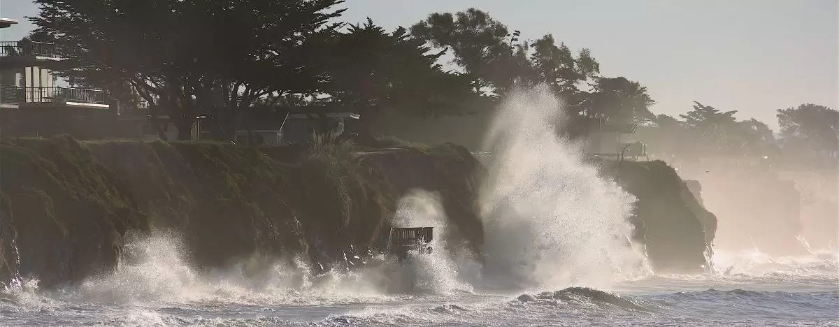
USGS geologist Patrick Barnard has documented that extreme El Niño events increase wave energy along the California coast by roughly 30 percent. During the 2015-16 El Niño, one of the three strongest on record alongside 1982-83 and 1997-98, winter wave energy equaled or exceeded historical maximums across the entire West Coast.
And beyond having some solid swell, that energy reshapes the coastline. Barnard and colleagues surveyed 29 beaches from Washington to San Diego and found winter erosion ran 76 percent above normal during 2015-16. Central California averaged around 150 feet of shoreline retreat. The event was particularly brutal because, despite massive waves, Southern California received 70 percent less rainfall than the previous two major El Niños. Rivers that normally replenish beaches with sediment ran dry. The waves took sand offshore, and nothing came to replace it.
La Niña pushes everything back north. The jet stream retreats, the storm track favors Oregon and Washington, and Southern California returns to its shadowed existence. Northwest swells dominate. The Channel Islands block everything.
The 2015-16 event highlighted the disconnect between waves and rain. Californians hoping El Niño would end the drought watched storms spin up massive swells, only to have high pressure deflect precipitation away from land. The coast got pummeled; the reservoirs stayed low. Sometimes the jet stream is in position and the storms are there, but the rain just doesn’t come. As for what it means for surfing, forecasts are what they are; go check a break and surf if it looks good.
Further Reading: